
Four methods cover every situation, and this page carries all of them with the tool first. The azimuth tool measures remotely in under a minute. Google Earth's ruler set to degrees returns the same number worldwide. A satellite image with a protractor lands within about 2 degrees. A compass plus the magnetic declination correction, true azimuth equals the reading plus east declination or minus west, verifies on site. The 0 to 360 scale anchors every reading: north 0, east 90, south 180, west 270. Accuracy inside 10 degrees of equator facing keeps 98.5 percent of output, and each method above clears that bar.
What Does Roof Azimuth Mean?
Roof azimuth is the compass heading of the roof face where solar panels mount, measured in degrees clockwise from true north across the full 360 degree circle. The roof azimuth tells you which direction the panel plane looks toward the horizon: due north reads 0 degrees, due east reads 90, due south reads 180, and due west reads 270.
The azimuth line you measure runs along the eave, the lower horizontal edge of the roof face, or perpendicular to the ridge. The ridge line and the eave line are parallel, so either one carries the same heading number. What you measure is the direction the face itself looks outward, not the line of the roof edge: a face whose eave runs east to west looks south and carries an azimuth near 180 degrees in the Northern Hemisphere.
The 8 compass directions anchor the scale:
| Direction | Azimuth | Direction | Azimuth |
|---|---|---|---|
| North | 0 / 360 deg | South | 180 deg |
| Northeast | 45 deg | Southwest | 225 deg |
| East | 90 deg | West | 270 deg |
| Southeast | 135 deg | Northwest | 315 deg |
Each step between the 8 directions spans 45 degrees, and the 16 point compass subdivides further in 22.5 degree steps: east northeast at 67.5, east southeast at 112.5, and so on. A roof azimuth reading between 168.75 and 191.25 degrees sits inside the south bracket, which is why solar planning tools that accept direction names like E, ESE, SE, and SSE stay close enough for panel planning.
How Do You Map Your Roof Azimuth with This Tool?
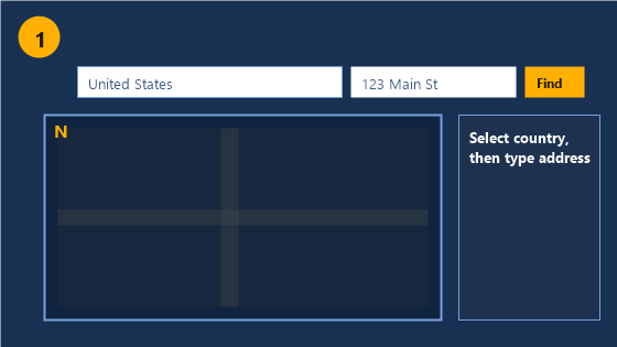
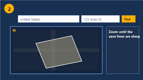
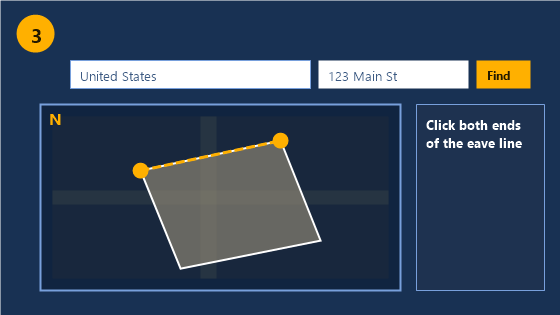
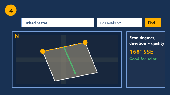
Map your roof azimuth with the tool above in 5 steps. Enter your address in the address field and the map loads the satellite image with north always at the top. Zoom to your roof until the eave lines are sharp. Click once on one end of the roof face's eave, then click once on the other end, drawing the line along the downward sloping edge of the face where panels would mount. The tool returns the azimuth in degrees, the compass direction name, and the solar quality of that direction for your hemisphere.
The result card reads three values:
- Azimuth in degrees, the 0 to 360 heading of the roof face
- Compass direction, the nearest of the 16 compass points
- Solar quality, Good for faces inside 45 degrees of equator facing, OK for faces inside 90, and Poor beyond, with the hemisphere applied automatically from the map location
The line belongs on the eave of the specific roof face, not the ridge of the whole building. A two face gable roof returns two different azimuths, one per face, and a hip roof returns one per slope. Measure each candidate face separately and the tool reports each result in order.
How Do You Check Roof Azimuth in Google Earth?
Google Earth measures roof azimuth with its ruler line tool. Open Google Earth Pro on desktop, search the address, and zoom to the roof. Open the Ruler from the Tools menu, set the units to degrees, and draw a line along the eave of the roof face by clicking one end, then the other. Google Earth reports the heading of the line: that number is the roof face azimuth. The method is free, works worldwide, and needs no account.
The Google Earth path answers the exact question homeowners and installers ask on forums: which way does a roof face from a desk, without visiting the site. The line tool's degree reading measures from north at 0 through east at 90, the same convention as the azimuth scale above, so the number transfers directly into any solar calculator's roof direction field. Google removed the simple compass overlay from consumer Maps and Earth, which is why the ruler method and dedicated azimuth tools fill the gap.
How Do You Measure Roof Azimuth from a Satellite Image?
Measure roof azimuth from any north up satellite image with a protractor. Open Google Maps in satellite view at the address: the top of the map is always north, the right edge is east. Hold a protractor against the screen with its origin on one corner of the roof face's eave and its baseline along the eave line, and read where the eave direction falls on the degree scale. Convert the protractor angle to a compass azimuth by measuring clockwise from the top of the screen.
Forum measurements of this method set its precision: an experienced eyeball guess lands within about 7 degrees of the true azimuth, and a protractor held on the screen lands within about 2 degrees. Both sit inside the tolerance band that solar planning needs, which the accuracy section below quantifies.
The satellite method works from any office. Installers checking a prospect's roof remotely, homeowners comparing several houses, and forum users in England or anywhere the US specific solar tools do not cover, all get the same result from a north up satellite image and a straight edge.
What If the Satellite Image Is Rotated?
Verify north before trusting any satellite image. Every standard satellite mapping tool orients north to the top of the map, the guarantee the mapping tools state directly: north is always at the top. Confirm it by zooming out until the coastline or the state or county shape matches a north up map. Some mobile map apps rotate the view for driving navigation, and that rotation silently changes every screen angle into something other than a true azimuth reading. If a compass rose appears on the map, its north needle points to the top in the correct orientation.
How Do You Find Roof Azimuth with a Compass?
Find roof azimuth on site with a compass and one correction. Stand facing directly away from the roof face, perpendicular to its eave, and read the compass heading: that reading is the magnetic azimuth of the face. Then apply the magnetic declination correction to convert it to a true azimuth: true azimuth equals the compass reading plus the declination when declination is east, and minus it when declination is west.
Declination varies by region. The United States spans roughly minus 13 degrees on the east coast to plus 15 degrees on the west coast, with near zero along the Mississippi corridor. A compass reading in Boston of 167 degrees converts to a true azimuth of 180: the reading runs 13 degrees low because declination points the needle west of true north. Skipping this correction misaims an array by the full local declination, which reaches 20 degrees in parts of the country and costs real production. The True South vs Magnetic South page carries the full declination method, and the NOAA World Magnetic Model in the sources gives the exact local value for any address.
Which Method Should You Use?
Choose the method by situation, not by accuracy alone. The comparison table below matches each method to its use.
The following table compares the 4 roof azimuth methods across accuracy, time, equipment, and situation.
| Method | Accuracy | Time | Equipment | Best for |
|---|---|---|---|---|
| This azimuth tool | exact | under 1 minute | any browser | Remote checks, comparing faces |
| Google Earth ruler | exact | 2 to 3 minutes | desktop, free | Verification, worldwide |
| Satellite plus protractor | within 2 deg | 3 minutes | any screen, protractor | No tool access, printed images |
| Compass plus declination | within 2 deg | 5 minutes | compass, declination value | On site verification |
The remote methods answer the office question: which way does the roof face before anyone drives there. The compass method verifies on site when the satellite image is ambiguous or the roof has complex geometry. Most projects run one remote method first and the compass only when the number decides the sale.
How Accurate Does Roof Azimuth Need to Be?
Roof azimuth needs accuracy inside a 10 degree band for premium production, and the tolerance widens from there. An azimuth within 10 degrees of the equator facing direction loses 0.5 to 1.5 percent of annual output. Within 20 degrees the loss runs 2 to 4 percent. Within 45 degrees it reaches 10 to 15 percent, and a full 90 degree miss into east or west facing costs 20 to 25 percent.
The tolerance means the 16 point compass brackets carry real planning weight. A roof measured to the SE bracket, 123.75 to 146.25 degrees, sits within 45 degrees of south in every case and within about 35 at the worst edge. Forum practice states the same rule from experience: anyone can read a satellite image within 22.5 degrees, and solar performance does not punish that band. Precision past the protractor level pays on large commercial arrays and off grid winter systems, where every percent compounds, and stops paying on residential flush mounts inside the tolerance.
What Do the Azimuth Degrees Mean for Solar Panels?
Azimuth degrees map to solar panel value in bands set by hemisphere. In the Northern Hemisphere, faces between 160 and 200 degrees sit in the prime band centered on true south at 180. Faces from 135 to 225 stay inside the good band. Faces from 90 to 270, east through south to west, remain workable with production shifted toward morning or afternoon. Outside 90 to 270, the north half of the compass, production drops to the compromise range. The Southern Hemisphere mirrors every band around true north at 0 degrees: its prime band spans 340 to 20 degrees.
The direction quality shifts with electricity value, not just total energy. A west facing face inside 240 to 270 produces 20 to 25 percent less annual energy than south but moves generation into the late afternoon hours that time of use rates price highest, which can raise the value of the kilowatt hours even as the count falls. Run any measured azimuth through the Solar Panel Angle Calculator, which takes the roof direction directly, and the Solar Orientation Calculator, which expands the direction result for the address.
What If You Have Several Roof Faces?
Measure every candidate face and let the azimuth bands pick the winner. A typical property carries 3 usable faces: one forum user measured a house face at 247 degrees, a garage at 157, and a ground stand at 138, and the garage and stand faces both beat the house for solar. The rule: list each face's azimuth, drop the faces outside the workable band for the hemisphere, and rank the rest by closeness to equator facing. The face closest to the prime band carries the array; the second face carries a second array when the roof allows it.
What Mistakes Distort Roof Azimuth Readings?
The 6 mistakes below each bend the reading away from the roof's true heading:
- Reading the ridge line against the slope direction, which returns the perpendicular of the face azimuth on gable roofs with symmetric pitch
- Skipping the declination correction on compass readings, which misaims by the full local offset, up to 20 degrees
- Trusting a rotated map view, which turns every screen angle into a wrong azimuth silently
- Measuring the neighbor's roof in attached or terraced housing, where satellite images merge rooflines
- Using a tool that reports azimuth in the opposite convention, subtracting 180 from the heading, without converting
- Confusing the roof face azimuth with the property line or street bearing, which runs parallel to the eave but faces the opposite direction
Roof Azimuth FAQs
How can I find my azimuth on a map? Find your azimuth on a map by opening a north up satellite image of your address, drawing or holding a line along the eave of your roof face, and reading the compass heading of that line clockwise from the top of the map. The azimuth tool above automates the reading, and Google Earth's ruler set to degrees returns the same number.
What is the azimuth angle of a roof? The azimuth angle of a roof is the compass heading of the roof face measured clockwise from true north, from 0 to 360 degrees. A south facing roof face in the Northern Hemisphere reads near 180 degrees, and the same face in the Southern Hemisphere reads near 0.
How do I check azimuth in Google Earth? Check azimuth in Google Earth by opening the Ruler tool, setting units to degrees, and drawing a line along your roof's eave. The heading Google Earth reports for that line is the roof face azimuth in the same 0 to 360 convention every solar tool uses.
How do I find my azimuth using a compass? Stand facing directly away from the roof face, read the compass heading, then correct for magnetic declination: add east declination to the reading or subtract west declination. The corrected value is the true azimuth.
Is Google Maps north always up? Google Maps orients north to the top of the map in every standard satellite and map view. Mobile navigation modes can rotate the view, so verify with the compass rose or zoom out to a recognizable coastline before measuring angles from the screen.
What azimuth is best for solar panels? The best azimuth for solar panels is the equator facing direction: 180 degrees true south in the Northern Hemisphere and 0 or 360 degrees true north in the Southern Hemisphere. Faces within 10 degrees of that heading lose under 1.5 percent of annual output, and faces within 45 degrees stay workable.
Sources: NOAA Solar Calculator · NOAA World Magnetic Model · NASA